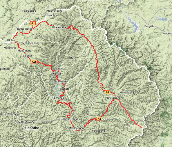
The “Roof of Africa” circular route should not be confused with the endurance race of the same name, as it refers to a complete circuit/loop encompassing the towns of Mokhotlong, Thaba-Tseka, Katse Dam, Pitseng, Butha-Buthe and Oxbow.

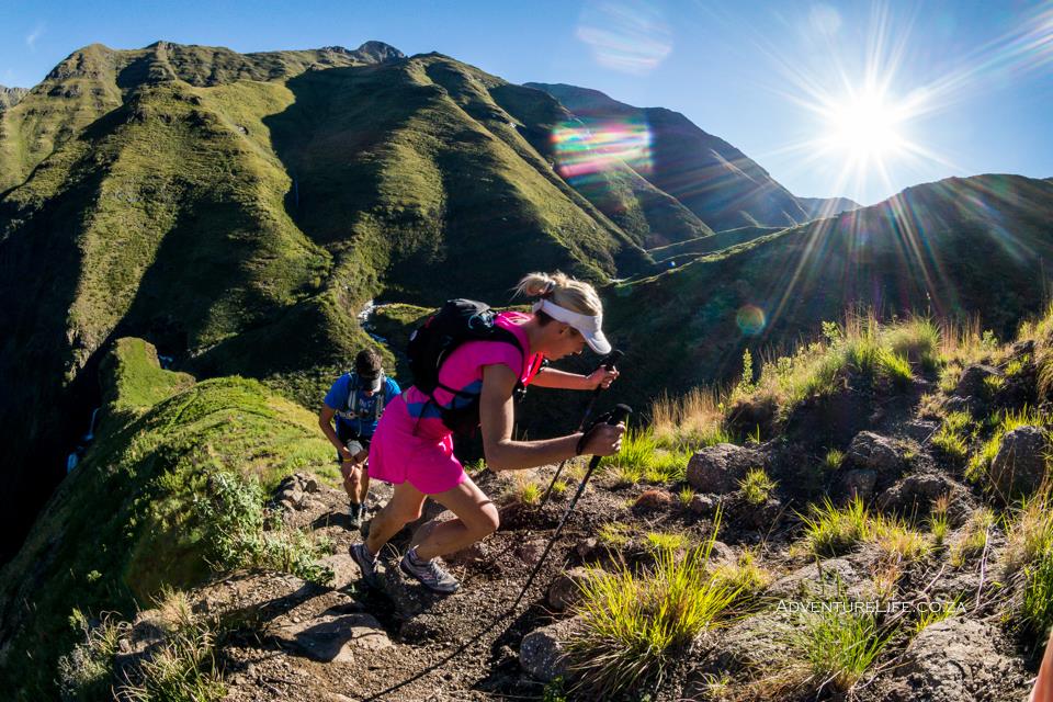
The reason behind the name (Roof of Africa) is that this route travels through the Maloti Mountain Range, with an altitude that surpasses 3251m above sea level and offers visitors to Lesotho breathtaking scenery of mountains, valleys, beautiful mountain streams and waterfalls.
Image: Mike and Ruby of 2canadiansonbikes.com
This popular route may not be entirely completed during a single trip into the Mountain Kingdom. However, the most trip will include at least a portion of it. The vast majority of visitors only have a single long weekend to dedicate to there trips and choose to enter via Sani Pass and exit via Caledonspoort (or vice-versa) in order to travel the long distances in their allotted time frame.
Although most of the route is tarred a 4×4 vehicle is mandatory to complete the southern section of the loop (A3) due to the roads and various sightseeing stops.
Accommodation is available at all around Lesotho ranging from the 5 star Maliba Mountain Lodge to various camping locations scattered throughout the mountains.
When planning a trip, especially if travelling on dirt roads, a good average to use is 25km/h. Weather plays a huge part in Lesotho travel and roads are quickly churned up if there is rain and rivers can rise very quickly indeed.
There are two popular starting points for this depending on where you call home. Caledonspoort (Fouriesburg) is the entry point for visitors from Gauteng while Sani Pass is the preferred entry point of those travelling up from KwaZulu-Natal. For those choosing the Sani Pass route please allow roughly 2 hours to complete the passage up to the Lesotho border post.
The Route (Clockwise from Sani Pass)
Sani Top (A31)
- Sani Pass reaches an altitude of 2874 meters.
- Kotisephola Pass (Black Mountains) reaches an altitude of 3280 meters.
Mokhotlong (A1)
Mokhotlong used to be known as one of the most secluded settlements in Africa and even today it is not a metropolis. The horses “parked” outside the little shops create a “Wild West” atmosphere.
- Menoaneng Pass reaches an altitude of 3030 metres.
Thaba-Tseka (A3)
Passing the remote villages of Linakaneng, Linakeng, Taung and Mohlanapeng when travelling from Mokhotlong.
The Koma-Koma Bridge can become flooded when the sluice gates of Katse Dam are opened.
Katse Dam (A8)
Eventually, we reach the beautiful Katse Dam and follow the western shore of it until we reach Katse Village. At Katse, you can take the morning tour into the interior of the Dam Wall.
Katse Dam is a popular stopover point as it can be a full 10 hour drive from Sani Pass top (+/- 190kms).
The Kao mine route offers the adventurous 4×4 explorers a shortcut through to the A1 in between Mokhotlong and Oxbow.
Pitseng (A8/A25)
Leribe (Hlotse) (A1)
Butha-Buthe (A1)
- Liphofung Caves and Cultural site
- Moteng pass reaches an altitude of 2840 meters. This is one of the steepest mountain passes in Lesotho. During the ascent, you will have the most magnificent views of the Eastern Free State.

Oxbow (A1)
- AfriSki Ski Resort
- The Letseng Diamond Mine (The highest Diamond Mine in the world)
The A1 road is generally good however the road becomes more potholed than tarred, the closer you get to Mokhotlong.
- Tlaeen Pass reaches an altitude of 3275 meters (the highest motor-able pass in Africa).
- Khalong-la-Lithunya (Pass of Guns) reaches an altitude of 3240 meters
The Kao mine route offers the adventurous 4×4 explorers a shortcut through to Pelaneng near Katse Dam.
At many of the lodges, guided hiking tours, pony trekking, swimming in the mountain streams are just some of the activities that are available for those wanting to have a break from driving.
Remember your passport and prepare for all weathers, no matter what time of year you travel.


5 Comments
I got a request to take a group of 25 into lesotho. enter at Fouriesburg and exit at Fouriesburg. They will be driving pipe cars that is roadworthy..Camping for 2 nights.. Do you got Any suggestions on the root and camping spots.
thank you.
christo
Hi Cristro,
I’m not quite sure what a “pipe car” is, so it’s hard to recommend routes that may or may not require a 4×4. However I can help in regards to the various camping sites around Lesotho. https://wp.me/p10pNs-8G
Did the trip from Sani Pass to Fouriesberg yesterday via A31 and A1 and I can safely say this is not for the faint-hearted and will take you between 4-6 hours not 2 – at the moment. Gathering this is from all the construction vehicles. The roads although tarred for a few kms out of Mokhotlong quickly turn to dirt track and are in a bad state. We did this in a Jeep Wrangler 4×4.
Hi im looking for some help here, i want to travel from clarens to katze dam and then onto Afriski and back to clarens, is this route tarred the whole way.
Riding a BMW 1200 Adventure,
I left Ficksburg morning early, via Fouriesburg to Afriski. Stopped outside Afriski, just had a look and made my way to Katze dam. I was completely wrong with my timing because of the slow progress, through small villages and winding roads with sharp bends and ice on the roads where there it is shadowy all day. Arrived at Katze dam, tired and very very cold.
From Clarens ? Do Katze dam and Afriski in 2 days, at least.